- Carlon Falls
- Shaver Lake
- Carson Pass
- El Capitan
- Preston Castle
- Silver Lake
- Tuolumne River
- Best Wineries in the Shenandoah Valley of Amador
- Sierra Marina
- Mirror Lake
- Blues Festival
- Lake Thomas A. Edison
- Nevada Fall
- Winery in Amador County
- Stanislaus National Forest
- Clearlake
- Rancheria Falls
- Half Dome in Yosemite
- Sutter Creek
- California Gold Rush History
- Brassfield Estate Winery
- Sierra National Forest
- Tourist Attractions in CA
- Mount Konocti
- Tourist Attractions in Yosemite
- El Dorado National Forest
- Restaurants in Lake County
- Indian Grinding Rock State Historic Park
- Yosemite Waterfall Hikes
- Things to Do at Huntington Lake California
- Mariposa Grove of Giant Sequoias
- Kennedy Gold Mine
- Top Tourist Attractions in Northern California
- Museum of the Sierra
- Yosemite Mountain Sugar Pine Railroad
- Discover Yosemite National Park
- Wine Tasting in Northern California
- Yosemite National Park
- Weekend Trips in California
- Yosemite Weekend Getaway
- Bridal Veil Waterfalls
- Shaver Lake in Winter
- Weekend Getaways in California
- Things to Do in Lake County
- Romantic Getaways in Northern California
- Yosemite Trails Horseback Adventures
- Weekend in Yosemite
- Christmas in Yosemite
Mount Konocti: The Complete Guide to Hiking Lake County's Iconic Volcano
Somewhere near the summit of Mount Konocti, the tree line breaks and Clear Lake opens up below you: 68 square miles of silver-blue water stretching to the horizon and the sudden, clear awareness that you are standing on top of a volcano. A real one. That moment is why hikers keep making the drive out to Lake County.
Rising to 4,305 feet above the south shore of Clear Lake, Mount Konocti is the most recognizable volcanic peak in Lake County, California. Part of the Clear Lake Volcanic Field, it last erupted approximately 11,000 years ago and is classified by the U.S. Geological Survey as a volcano with 'High Threat Potential', though its current alert level is normal. The volcanic activity beneath the Clear Lake Volcanic Field also contributes to the geothermal energy systems that power The Geysers nearby, the largest geothermal power plant complex in the world.
Seasoned hikers chasing panoramic views, birdwatchers hoping to spot a bald eagle on a thermal, and anyone looking for a genuinely spectacular day outdoors will find that hiking in Lake County starts here.

A Mountain With a Story: Volcanic History and Cultural Significance
Mount Konocti began forming approximately 350,000 years ago, with core samples dated as far back as 480,000 years. Its five distinctive peaks are Wright Peak (4,299 ft), Howard Peak (4,286 ft), South Peak (4,286 ft), Buckingham Peak (3,967 ft), and Clark Peak (2,880 ft). The northeast face is so densely forested that locals call it the "Black Forest," a slope that receives almost no direct sunlight.
For the Pomo people, who have lived in this region for more than 11,000 years, Mount Konocti is sacred ground. In one Pomo language, the name translates to "Mountain Lady." Legend holds that the mountain formed when the great chief Konocti fell in battle, and his body became the land itself. The obsidian produced by the volcano was prized for tools and trade across the wider region for thousands of years.
The mountain’s relatively young volcanic soils help explain why Lake County is one of the fastest-growing wine regions in the state. Rich, mineral-dense ground produces grapes with distinctive character, and the vineyards that ring the base of the mountain are part of that story.
Mount Konocti County Park: Where the Hike Begins
Opened on September 24, 2011, Mount Konocti County Park is the largest park managed by Lake County. It covers more than 1,500 acres of high-elevation wilderness, including ancient forests, volcanic peaks, working orchards, and some of the most rewarding trail terrain in Northern California.
The park sits just east of Kelseyville and is managed in partnership with Konocti Regional Trails. To reach the main trailhead, turn off Konocti Road past Kelseyville High School, where the pavement transitions to a dirt road. Follow it approximately two miles to the parking area. Vault restrooms are available at the trailhead and along the trail.
- Day pass required (Lake County Department of Public Services)
- Hours: Dawn to dusk, daily
- Parking: Free
- Dogs: Allowed on leash

The Trails: What to Expect on Your Hike

The Trails: What to Expect on Your Hike
Wright Peak Summit Trail: The Classic Route
This is the trail most people come for. The Wright Peak Summit Trail follows a wide, well-graded gravel road to a Cal Fire lookout tower offering 360-degree views. On clear days, you can see Mount Diablo, Mount Lassen, Mount St. Helena, Snow Mountain, and more than 70 square miles of Clear Lake. Along the way, the trail passes the remains of the Mary Downen cabin and a stretch of ancient canyon live oak, one of the few shaded stretches along the route.
- Distance: 7.6 miles out and back
- Elevation gain: 1,600 to 1,958 feet
- Time: Four and a half to five hours round trip
- Difficulty: Hard (sustained climb; non-technical surface)
Buckingham Peak: The Side Trip Worth Taking
About 2.6 miles from the trailhead, a fork offers access to Buckingham Peak. Views are partially screened by trees and telecommunications equipment, but the perimeter walk delivers clear glimpses of Clear Lake and the valley. Best combined with Wright Peak for a full day on the mountain.
- Distance from fork: 2.6 miles round trip
- Difficulty: Moderate
Howard Peak: The Quieter Summit
Less visited and noticeably wilder, Howard Peak is a half-mile detour from the saddle between the two upper summits. Slightly lower than Wright, Howard Peak is far less crowded. A worthwhile addition for hikers who want the full mountain experience.
- Distance from saddle: Half a mile each way
- Difficulty: Moderate


When to Go: Best Seasons for Hiking Mount Konocti
Spring (March through May) and fall (September through November) are the most rewarding windows. Spring brings wildflowers, mild temperatures, and excellent visibility across the lake. Fall delivers crisp air, vivid hillside color, and some of the clearest summit views of the year.
Summer hiking is possible but temperatures regularly exceed 90 degrees Fahrenheit on exposed sections. Start no later than 7:00 a.m. to beat the heat. The trailhead is typically accessible year-round, though winter rain can make the dirt access road slick.
Safety on the Trail: Come Prepared
Conditions shift quickly at elevation. Even on warm days, pack a light layer for the summit. In summer, the exposed upper sections hold heat intensely. Start early and plan to be off the mountain by early afternoon.
There is no water available anywhere on the trail. Carry a minimum of two liters per person; in summer, three liters is a safer baseline. Mountain lions and rattlesnakes are both present in the park. Rattlesnakes are most active between April and October. Stay on marked trails, keep children close, keep dogs on leash, and avoid hiking at dawn and dusk. Poison oak grows throughout the hillsides: clusters of three shiny, reddish-green leaves.
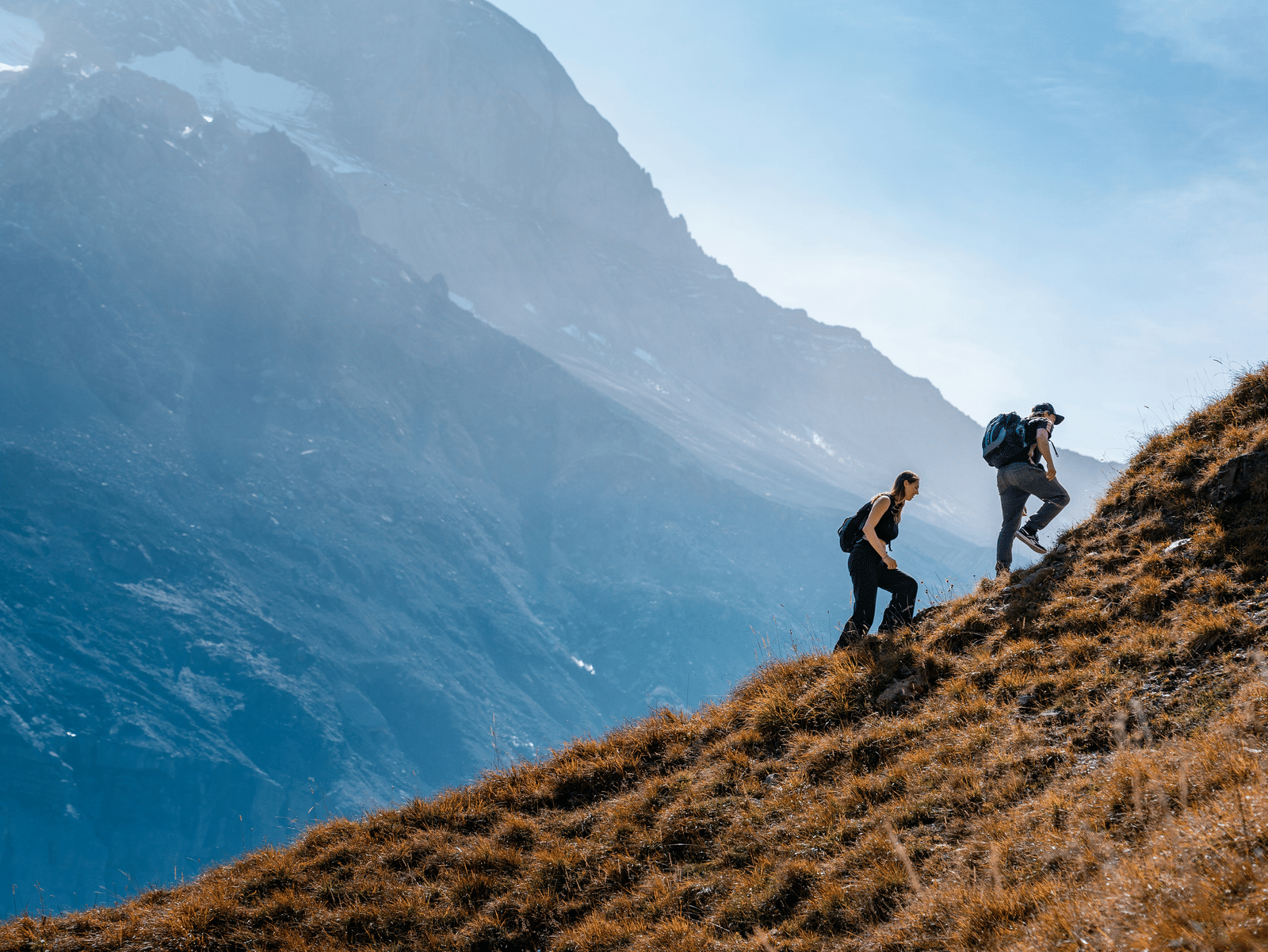

Gear Checklist
- Sturdy hiking shoes with ankle support
- Sunscreen, wide-brim hat, and sunglasses
- At least two liters of water per person
- Snacks and a light layer for the summit
- Basic first aid kit
- Fully charged cell phone
- Binoculars (strongly recommended for summit views and birdwatching)
What to Watch For: Views, Birds, and Photography
From Wright Peak, Clear Lake spreads out below you in full: California's largest natural freshwater lake and one of the oldest lakes in North America. On crystal-clear days, the Sacramento Valley is visible approximately 50 miles away. The sight of cloud formations building in the lake's microclimate while you stand above them is one of those views that rewards the climb immediately.
Lake County is legitimate birding territory. Mount Konocti's slopes support bald eagles, osprey, burrowing owls, wild turkeys, California quail (the state bird), and a wide range of raptors. Bald eagles are frequently spotted riding thermals above the lake, especially in the morning hours.


Birdwatching Beyond the Mountain:
- Cache Creek Natural Area (BLM): Outstanding for nesting bald eagles in winter
- Anderson Marsh State Park: Monthly docent-led nature walks; excellent year-round birdwatching
- Blue Lakes and Clear Lake Shoreline: Reliable sightings of feeding osprey
- Audubon Heron Days: Expert-led spring boat tours of Clear Lake
Golden hour light hits the volcanic slopes dramatically. The orchard stretch on the lower trail gives strong foreground interest. Summit views are sharpest in fall and winter when atmospheric haze is at its lowest. A wide-angle lens earns its keep at the top: Clear Lake at 70 square miles does not fit in a standard frame.
Hiking in Lake County: Beyond Mount Konocti
The region's mix of volcanic soils, oak savanna, chaparral, freshwater marshes, and lakeside terrain creates genuinely varied trail experiences within a short drive of each other.
- Anderson Marsh State Historic Park: One of California's finest freshwater marsh ecosystems, right on the shore of Clear Lake. Exceptional birdwatching year-round.
- Cache Creek Natural Area: Remote canyon hiking and wildlife viewing in rugged backcountry. One of the best places for spotting nesting bald eagles in winter.
- Clear Lake State Park: Gentler lakeside trails with direct water access. Well-suited to families. Picnic areas, swimming, and boat access.
- Cow Mountain Natural Area: More than 50,000 acres of managed public land for those seeking solitude and a physical challenge.
Hiking in Lake County delivers a different experience on each trail. Add a post-hike winery stop on the drive back and the day completes itself naturally.

Feel at Home at Tallman Hotel
After a full day on Mount Konocti, the right place to land matters. Legs worked, lungs full of clean air, head full of views: Tallman Hotel in Upper Lake is exactly where you want to be.
Nestled in the historic heart of Lake County at 9550 Main Street, Upper Lake, this beautifully restored 1890s auberge was thoughtfully restored in 2006 to reflect its gold-rush-era character. Listed on the California Register of Historical Resources as a Point of Historical Interest, the hotel blends period charm with quiet modern comfort across 17 thoughtfully appointed rooms.
The grounds are as much a draw as the rooms. Soak in a private geothermal-heated Japanese Ofuro tub under the stars. Take a dip in the seasonal pool. Sit on the wrap-around veranda as the light goes down over the hills.
Next door, the Blue Wing Restaurant and Saloon is a recreation of the original bar and restaurant that operated on the property from the 1880s to the 1920s. It serves locally inspired food with live music most evenings: exactly the kind of dinner that makes the end of a long hike feel like an occasion.
Explore room options from Veranda Rooms with wraparound porch access to Lower Garden Rooms with private patios and Ofuro tubs. The hotel is minutes from Clear Lake, within easy reach of Mount Konocti County Park, Anderson Marsh, local wineries, and the trails of Konocti Regional Trails.
Your hike starts on the mountain. It ends here.
Book a Room | Blue Wing Restaurant | Hotel Features | Local Adventures | Contact Us
FAQs
1. Where is Mount Konocti located?
Mount Konocti sits in Lake County, California, on the south shore of Clear Lake. The trailhead for Mount Konocti County Park is accessed via Konocti Road, just east of Kelseyville.
2. How difficult is the hike to the summit of Mount Konocti?
The Wright Peak Summit Trail is rated hard, primarily due to its sustained elevation gain of 1,600 to 1,958 feet over a 7.6-mile out-and-back. The surface is a wide, graded gravel road throughout, with no technical scrambling required. Good fitness and the right gear are the main requirements.
3. How long does it take to hike Mount Konocti?
Most hikers complete the Wright Peak Summit Trail in four and a half to five hours round trip, including rest stops. Fit hikers can do it in under three hours. Add time if you plan to visit Buckingham Peak or Howard Peak as well.
4. What is the best time of year to hike Mount Konocti?
Mount Konocti County Park is at its best in spring (March through May) and fall (September through November). Spring brings wildflowers and mild conditions; fall offers crisp air and vivid color. Summer is possible but hot; start no later than 7:00 a.m. and carry extra water.
5. Is there a fee to enter Mount Konocti County Park?
A day pass is required and available through the Lake County Department of Public Services. Parking at the trailhead is free. The park opens at dawn and closes at dusk. Dogs are welcome on leash.
6. What wildlife can I expect on the trail?
Rattlesnakes, mountain lions, deer, bald eagles, osprey, wild turkeys, and California quail all live in and around Mount Konocti County Park. Stay on marked trails, avoid dawn and dusk hiking, and keep pets leashed at all times.
7. What other places are good in Lake County?
Hiking in Lake County beyond Mount Konocti includes Anderson Marsh State Historic Park for lakeside and marsh trails, Cache Creek Natural Area for remote backcountry terrain, Clear Lake State Park for gentler family-friendly walks, and Cow Mountain Natural Area for rugged, solitude-focused hiking across more than 50,000 acres.
8. Where should I stay when visiting Mount Konocti?
Tallman Hotel at Serenite Collection in Upper Lake is an ideal base. The restored 1890s boutique hotel is minutes from the lake, within easy reach of Mount Konocti County Park, and offers 17 rooms, geothermal-heated Ofuro tubs, a seasonal pool, and dinner at the Blue Wing Restaurant and Saloon.
Subscribe to Our Newsletter
Subscribe to unlock insider access, special promotions, and unforgettable retreats!
Continue your booking